
17 August 1829
A Singular Day on the Thames Tideway
“a scene of animation scarcely, if ever, equalled.”
Part III
29 December 2017
Peter Mallory completes his Backsplash presentation (see Part I and Part II):

As we proceed further upstream on 17 August 1829, the regattas were no longer about supporting the neighbourhood watermen but about providing challenging contests upon which gentlemen could wager.
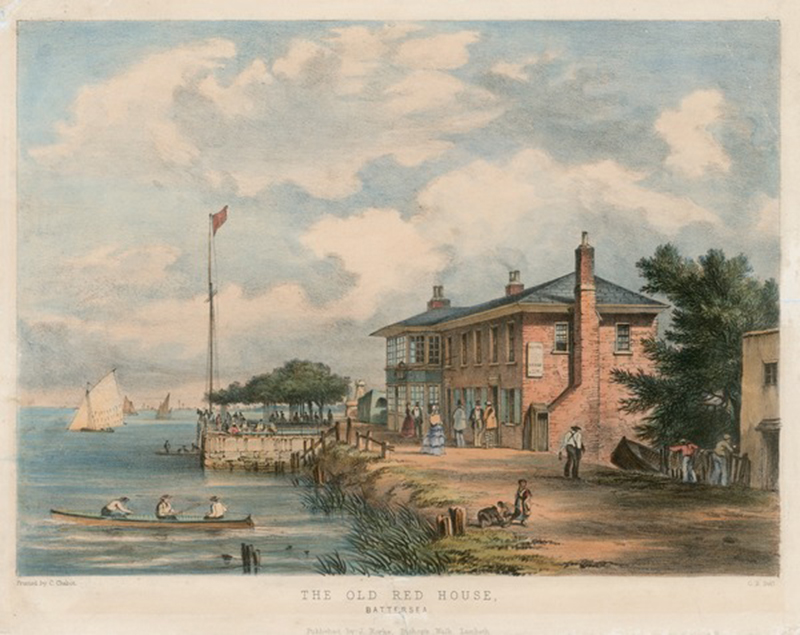
Red House Sovs.
Contest for a Purse of Sovereigns
Given by Mr. Swayze
The next regatta took place at the Red House, an inn and pub located in the rural Surrey countryside . . .
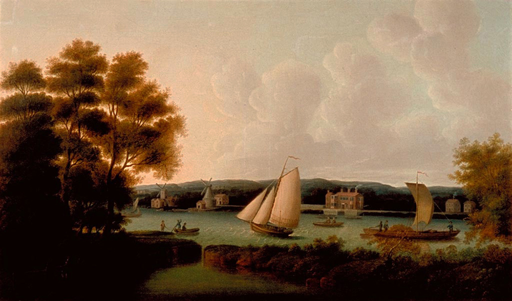
In the foreground the Grosvenor Canal empties into the Thames.
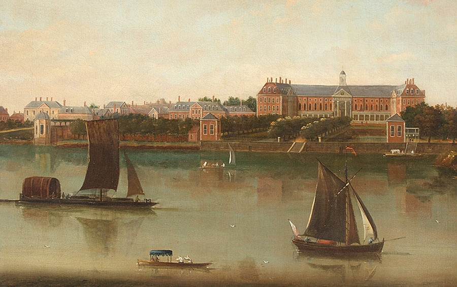
This 18th Century painting of the Royal Hospital, Chelsea shows the view across the river from the front door of the Red House. We definitely have left behind the urban environs of London.
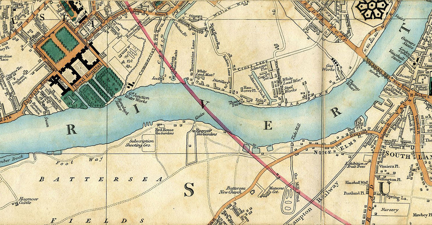
In addition to rowing competitions, the Red House was well known for pigeon shooting contests. This detail from Cary’s New Plan of London and its Vicinity from 1837 shows the adjacent “Subscription Shooting Ground”.
The prize on 17 August was a purse of sovereigns provided by a Mr. Swayze, described by Bell’s Life as one of “the most liberal patrons of the river sports,” who had taken rooms at the Red House that summer. Swayze was sharply criticized by Bell’s Life for twice postponing his contest. At its conclusion, he was never mentioned again in rowing history.
Twelve landsmen (in other words, members of the artisan class who were not watermen, and therefore hard for bookmakers to handicap) competed in six wherries rowed as pairs.
No description of the course or the results survive . . .

. . . but here is a depiction of a quite similar contest from 1826, competitors identified by brilliant colours – think back to the regatta handbill from the Leander Library – in four pairs passing the Red House, shadowed by two cutters and a steam launch.
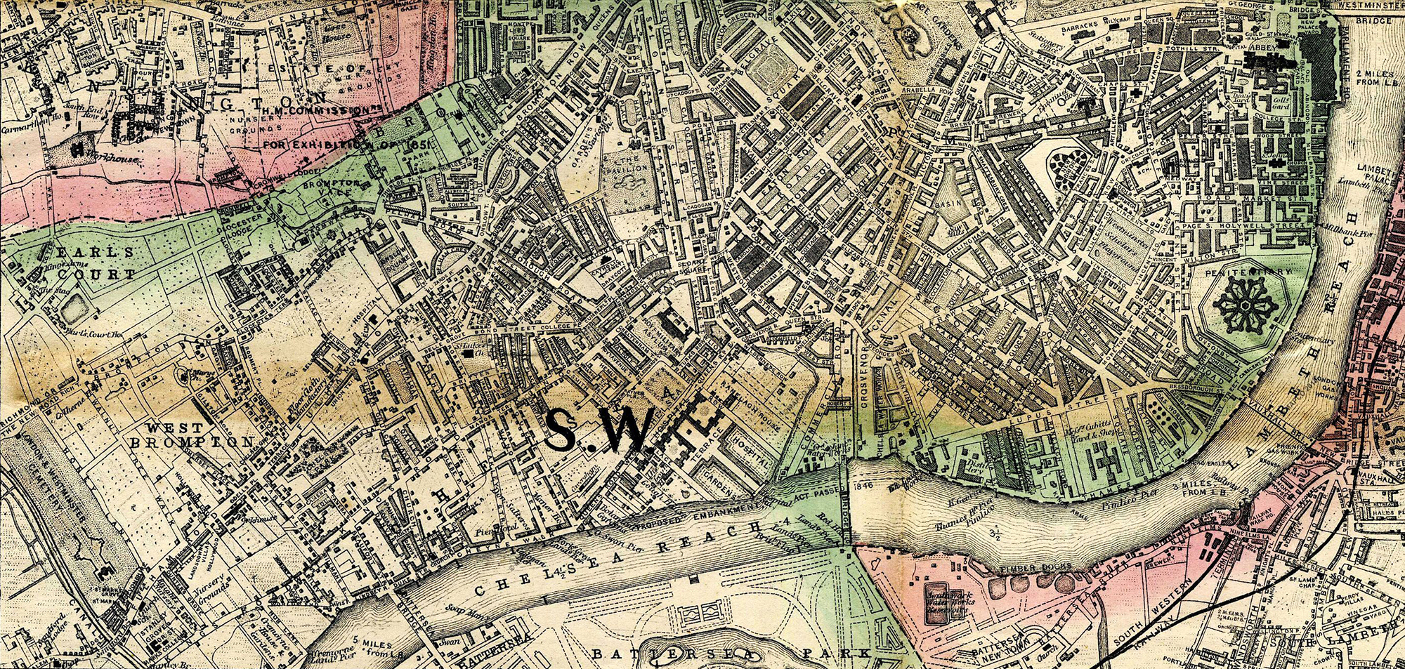
Careful examination of this detail from the Post Office Directory Map of 1857 shows the ultimate fate of the Red House. It was demolished to make way for Chelsea Bridge, which opened the following year.
The next contest from 17 August took place at the village of Battersea.
A Match Between Four Landsmen of Battersea
For a Purse of Sovereigns
Let us again orient ourselves with our modern map . . .
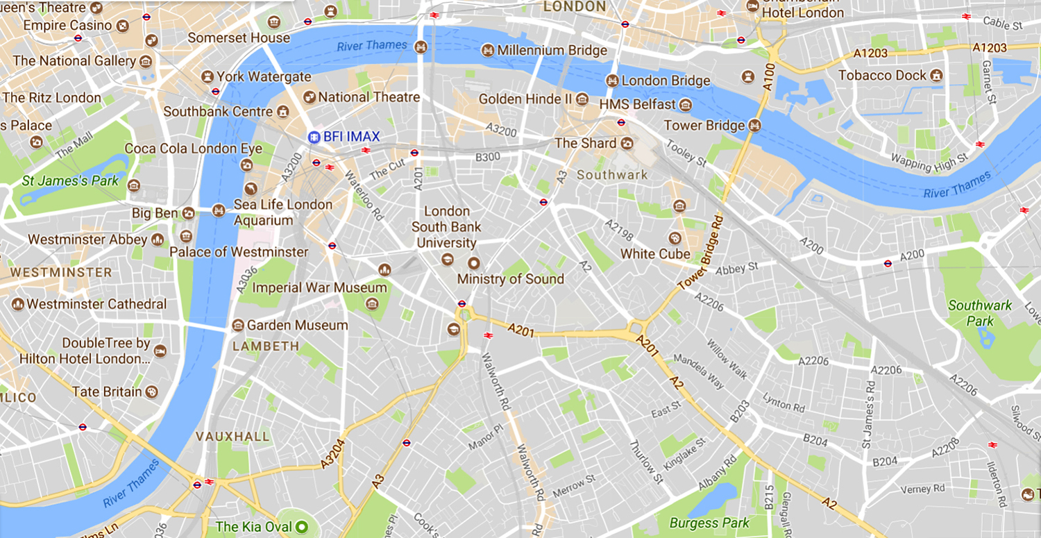
. . . and now widen the view.
Past the Chelsea Reach, adjacent to Battersea Park, in the lower left corner of the map is Battersea Bridge, with the village of Battersea around the bend on the Surrey bank.
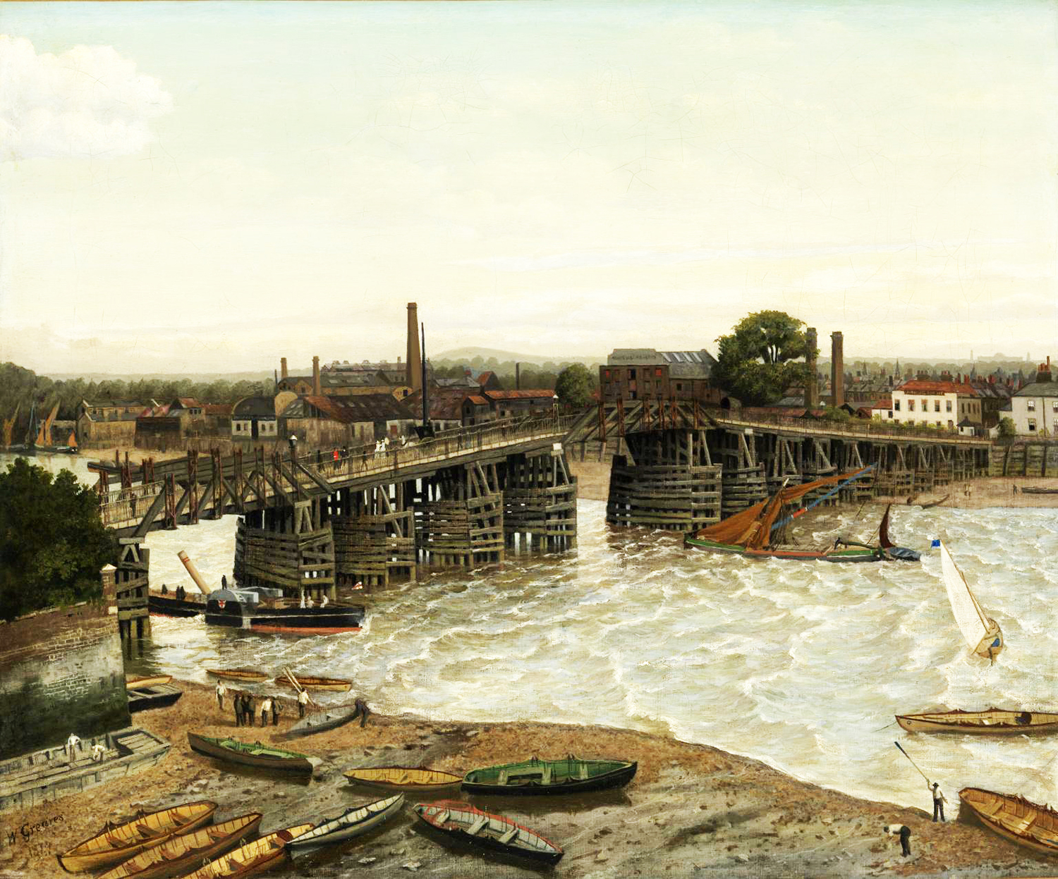
Here is the original Battersea Bridge in 1874, a century after it was constructed, looking downstream from the Chelsea bank. Note the mud flats on both sides of the river at low tide. This painting in the Tate Britain is by Walter Greaves, a Thames waterman who was one of the first pupils of the American artist James Whistler.
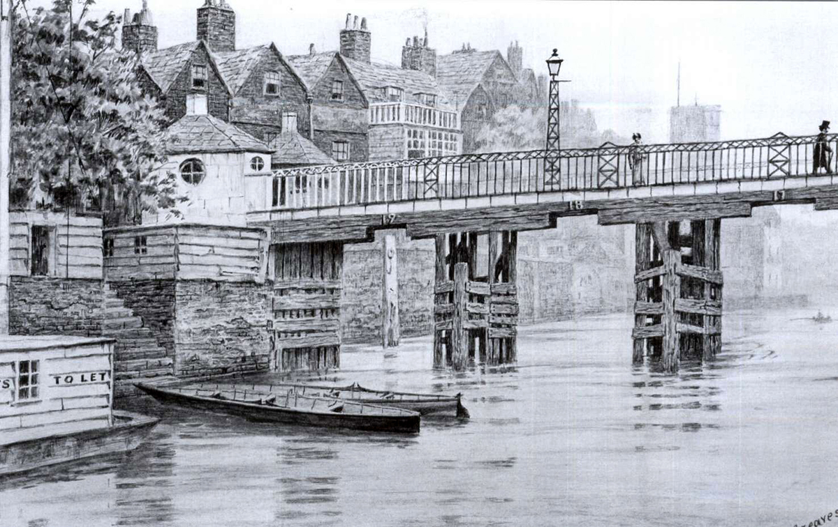
Indeed, that may be Whistler striding over the bridge toward Battersea in this Greaves watercolour. The stairs shown led to the workshop of Greaves’ father, Charles, also a Thames waterman. See the tollbooths. Crossing most bridges in the London environs cost money.
Note that each opening below the bridge was numbered. Greaves described the danger to shipping and the difficulty of steering through the arches unless the “set of the tide was known”.
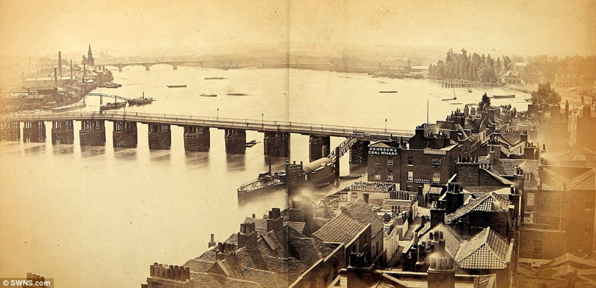
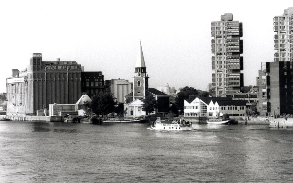
This is a photo of Battersea Bridge taken some time after 1860, looking upstream. In the distance on the left bank is the village of Battersea, already being encroached upon by industry.
All we know of the race held there on 17 August 1829 is that four landsmen competed starting from The Old Swan Tavern Battersea . . .
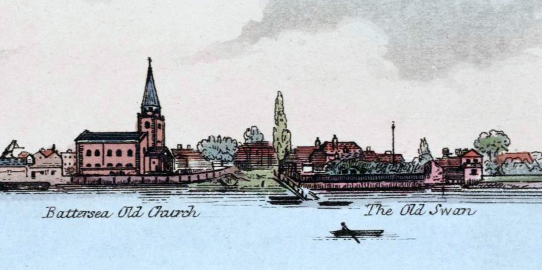
. . . this Old Swan distinct from the Old Swan Taverns at London Bridge and across the river in Chelsea. These latter two formed the start and finish lines for the annual “Swan to Swan” Doggett’s Coat and Badge course.
Next to The Old Swan Battersea was St. Mary’s Church . . .
. . . which still stands, though the village atmosphere disappeared long ago. In the 1960s, there was a pub called The Old Swan on the original site . . .
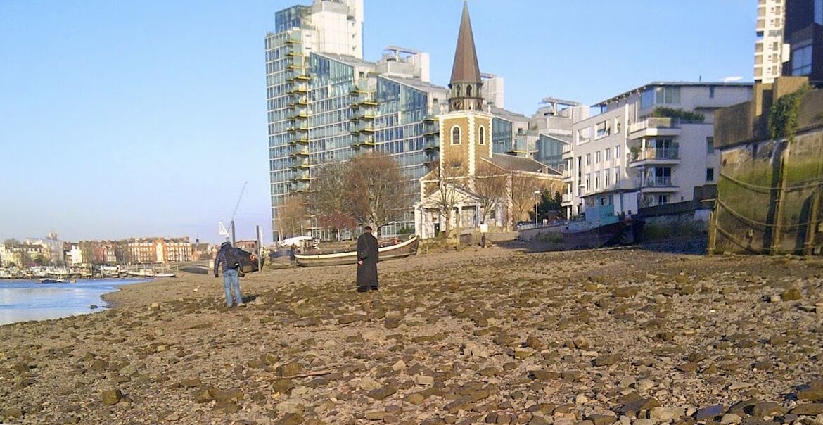 . . . but today even that has been gone for decades.
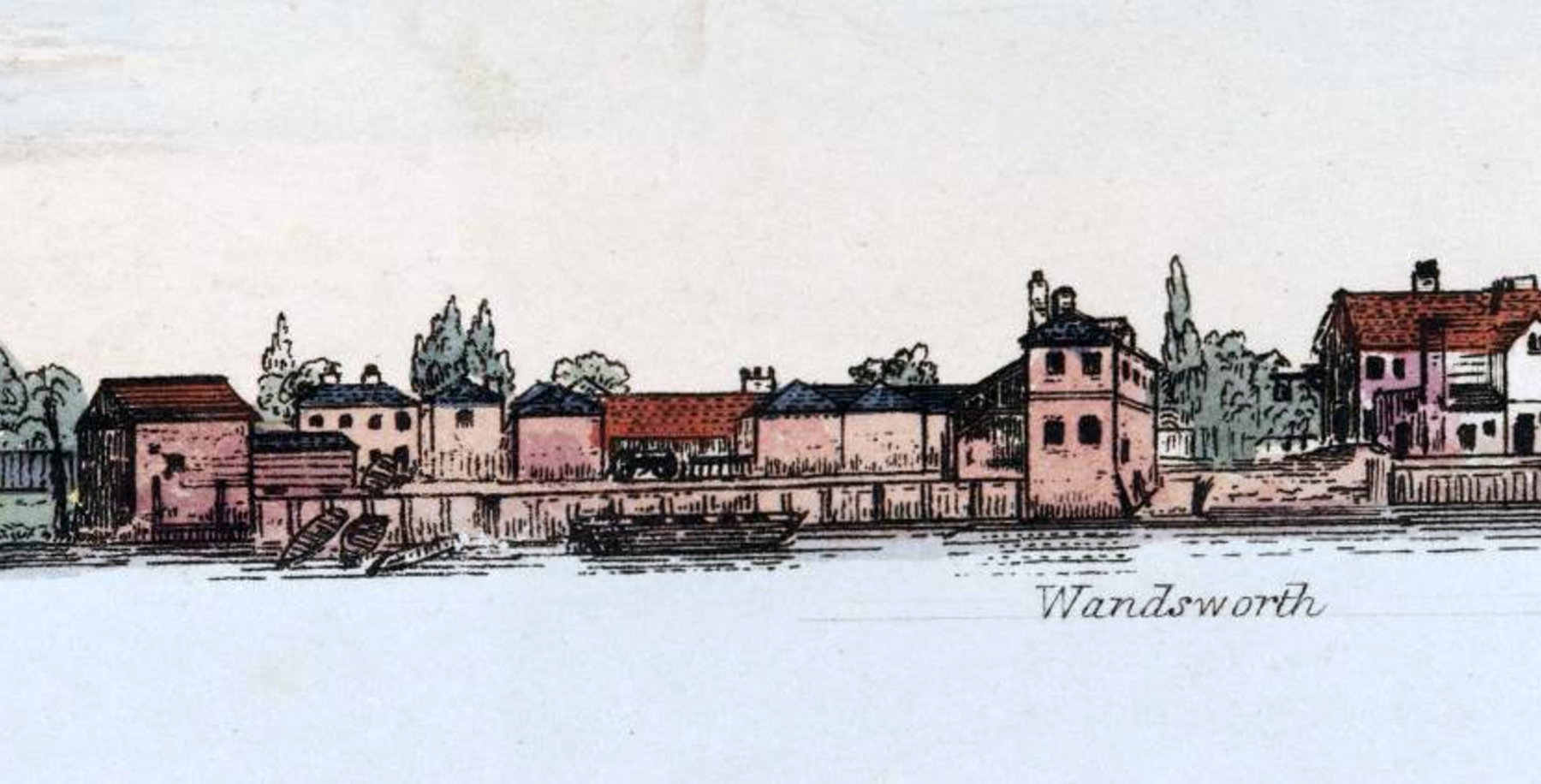
The last regatta that we will examine took place in Wandsworth, the next village upstream from Battersea on the Surrey bank.
Wandsworth Regatta
For a Purse of Sovereigns
Given by the Inhabitants of Wandsworth
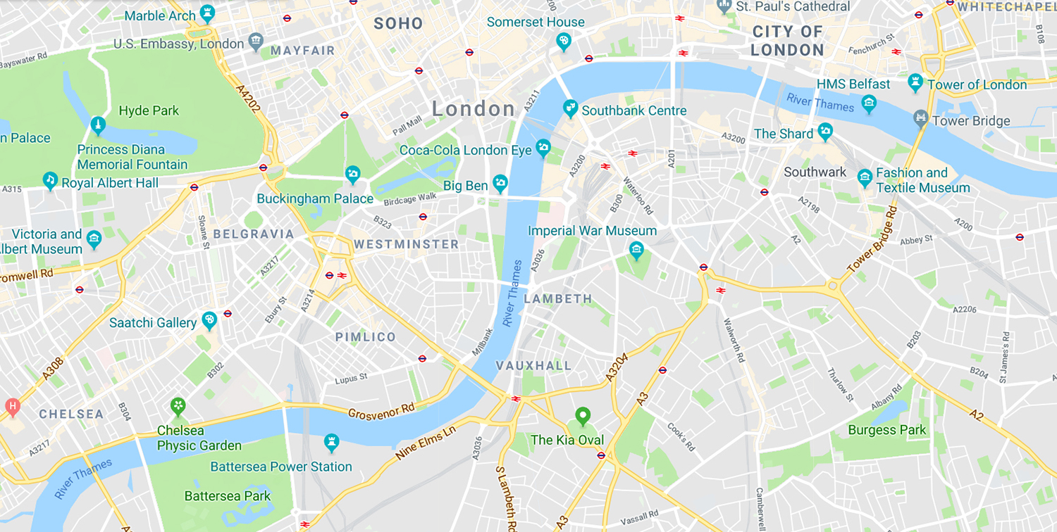
Let us turn to a detail of Stanford’s Library Map of London and Its Environs of 1864.
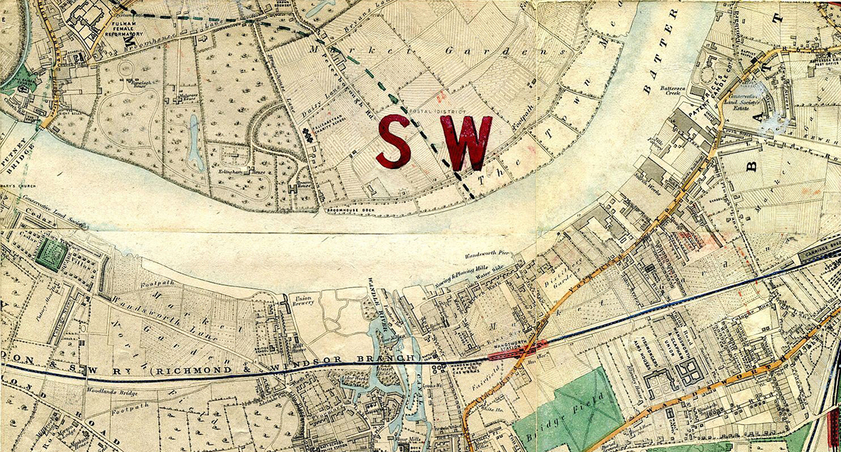
At the upper right is the upstream end of the village of Battersea. Wandsworth is found just a short distance further upstream in the lower centre between Wandsworth Pier and Wandle River.
Eight wherries rowing as pairs, each containing one waterman and one landsman, again hard to handicap, competed in two heats of four each. The top two in each met in the final heat for the prize.
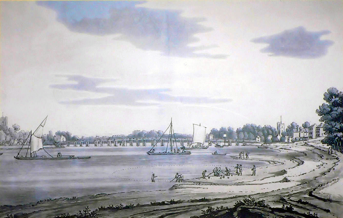
The race stayed directly in front of the town, and thanks to the Panorama of the Thames, we know exactly how it looked in 1829. The course began at the White Horse Tavern . . .
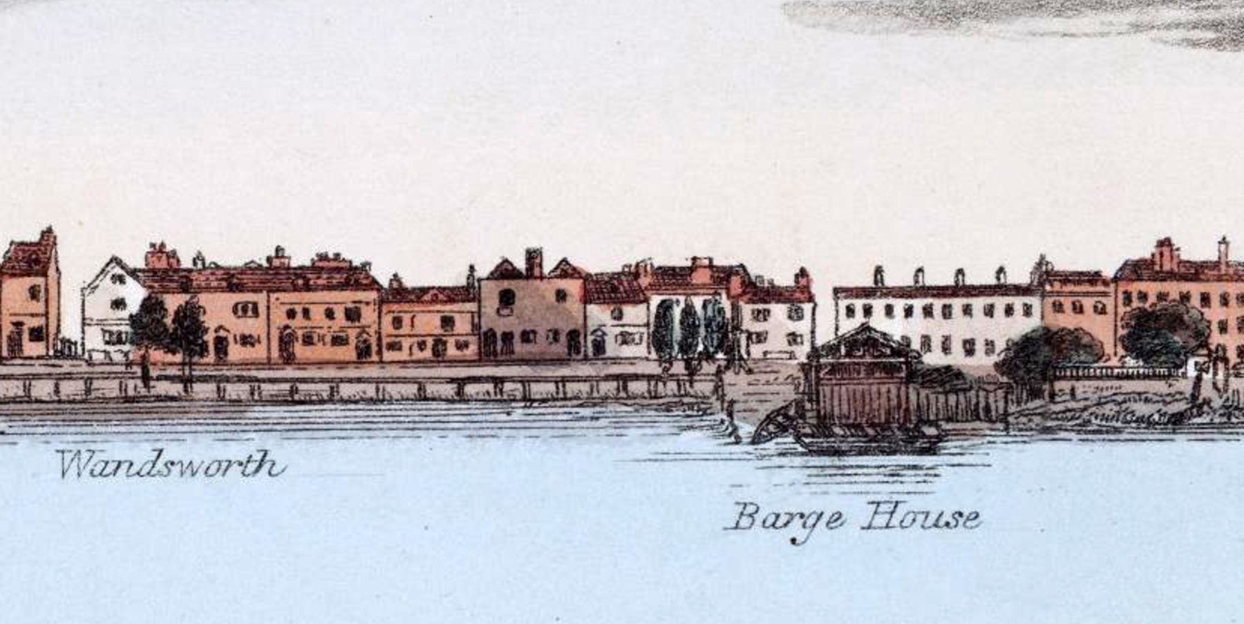
. . . behind the three trees, round a boat moored off what Bell’s Life called Wandsworth Creek, but the 1864 map and other sources call Wandle River . . .

. . . shown here flowing by the Flour Mill at the upstream end of town, back to a boat moored off Carterhithe at the downstream end of town . . .
. . . hithe meaning “landing place”, labelled as Wandsworth Pier on the map, and then returning to the White Horse. Each heat went three times round for a total of 2.64 miles and a very challenging six 180˚ turns. Lots of opportunities for fouling.
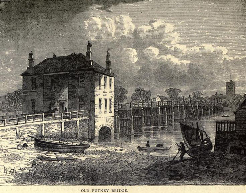
Though we have no reports of regattas further upstream of Wandsworth on 17 August 1829, I would be remiss if our visual journey did not continue one more mile upstream and visit the town of Putney.
Here is a 1793 aquatint by Joseph Farington looking downstream with the villages of Fulham on the left and Putney on the right. The churches on either side can still be seen today.
When it was constructed in 1729, Putney Bridge was only the second bridge after old London Bridge on the entire Thames Tideway, and it attracted the attention of many artists.
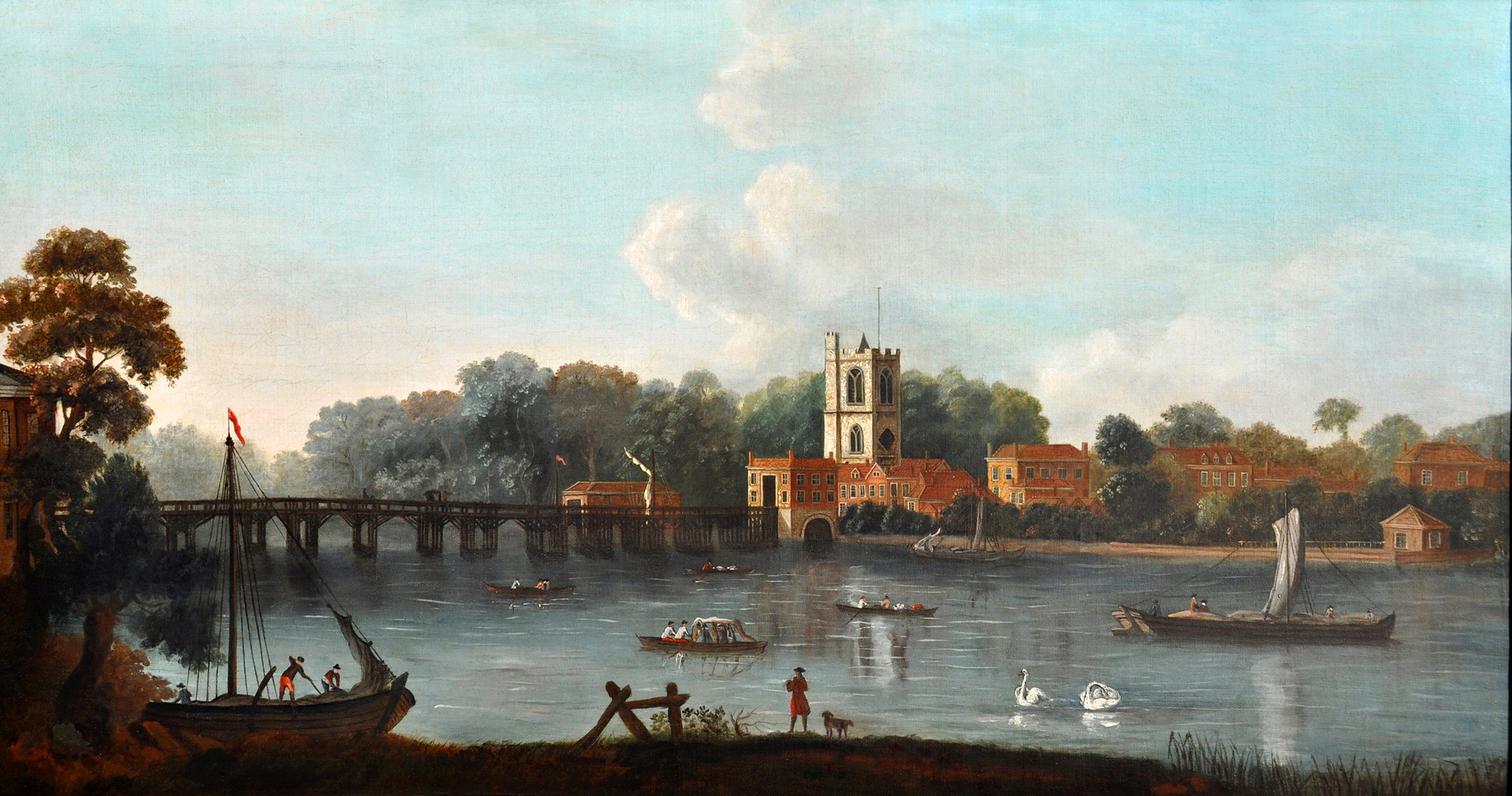
This view towards Fulham, All Saints’ Church and the Bridge Toll House was painted by Joseph Nicholls shortly after the bridge was built.
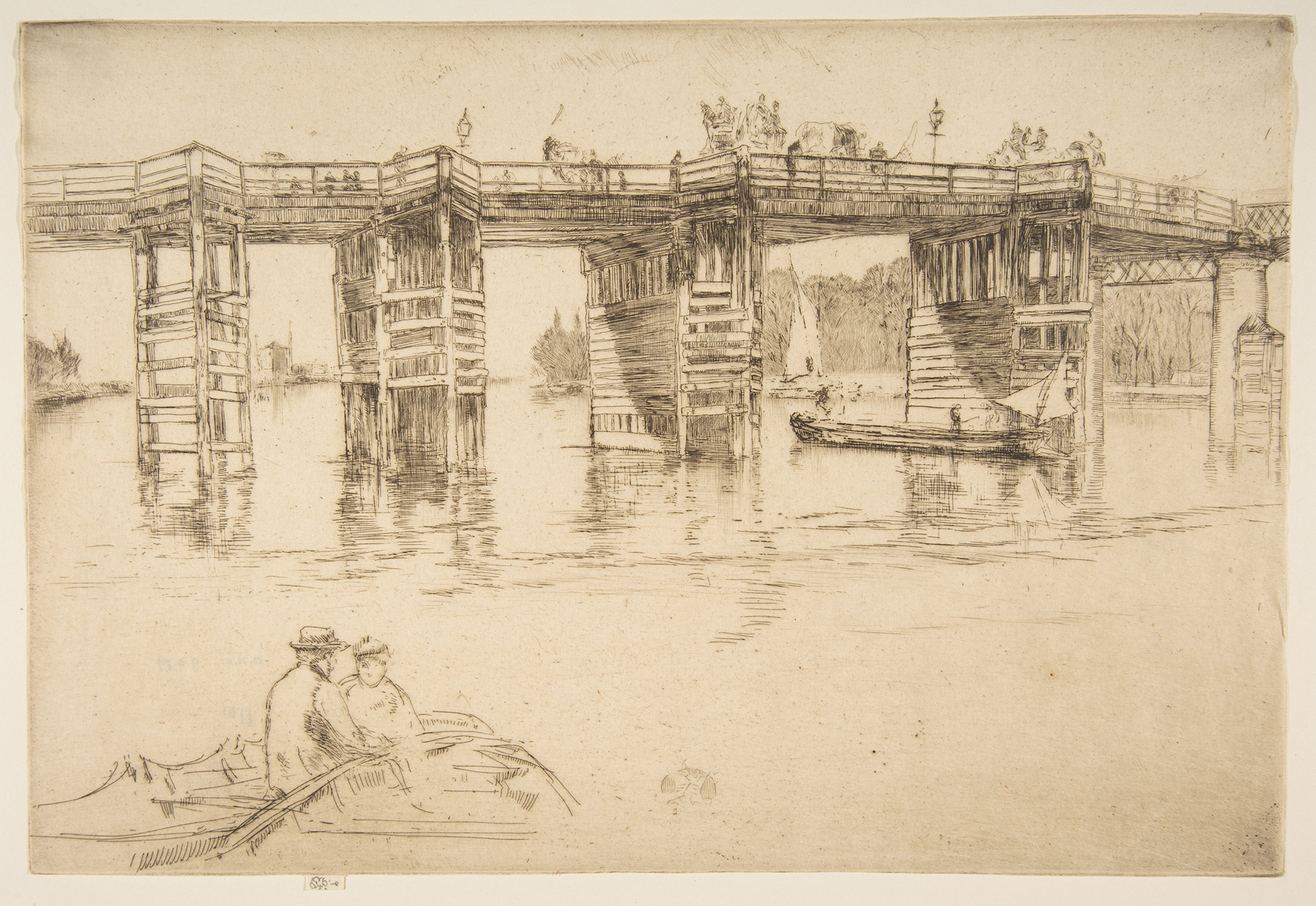
James Whistler made this etching in 1879 . . .
. . . and this engraving by W.J. Palmer is from about the same time.
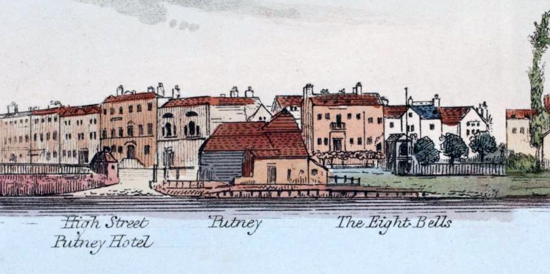
In our year of 1829, various pubs in Putney were popular destinations for amateurs, notably including the Leander 6-oared cutter, which would regularly row the more than five miles up from Lambeth, partake of a sumptuous repast, and return in the evening.
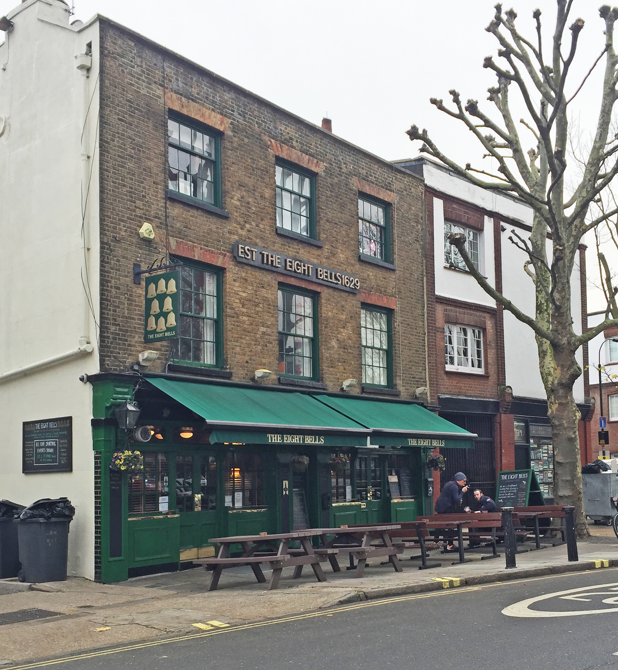
A favourite pub amongst rowers was the Eight Bells . . .
. . . and a pub of that name exists today across the river in Fulham.
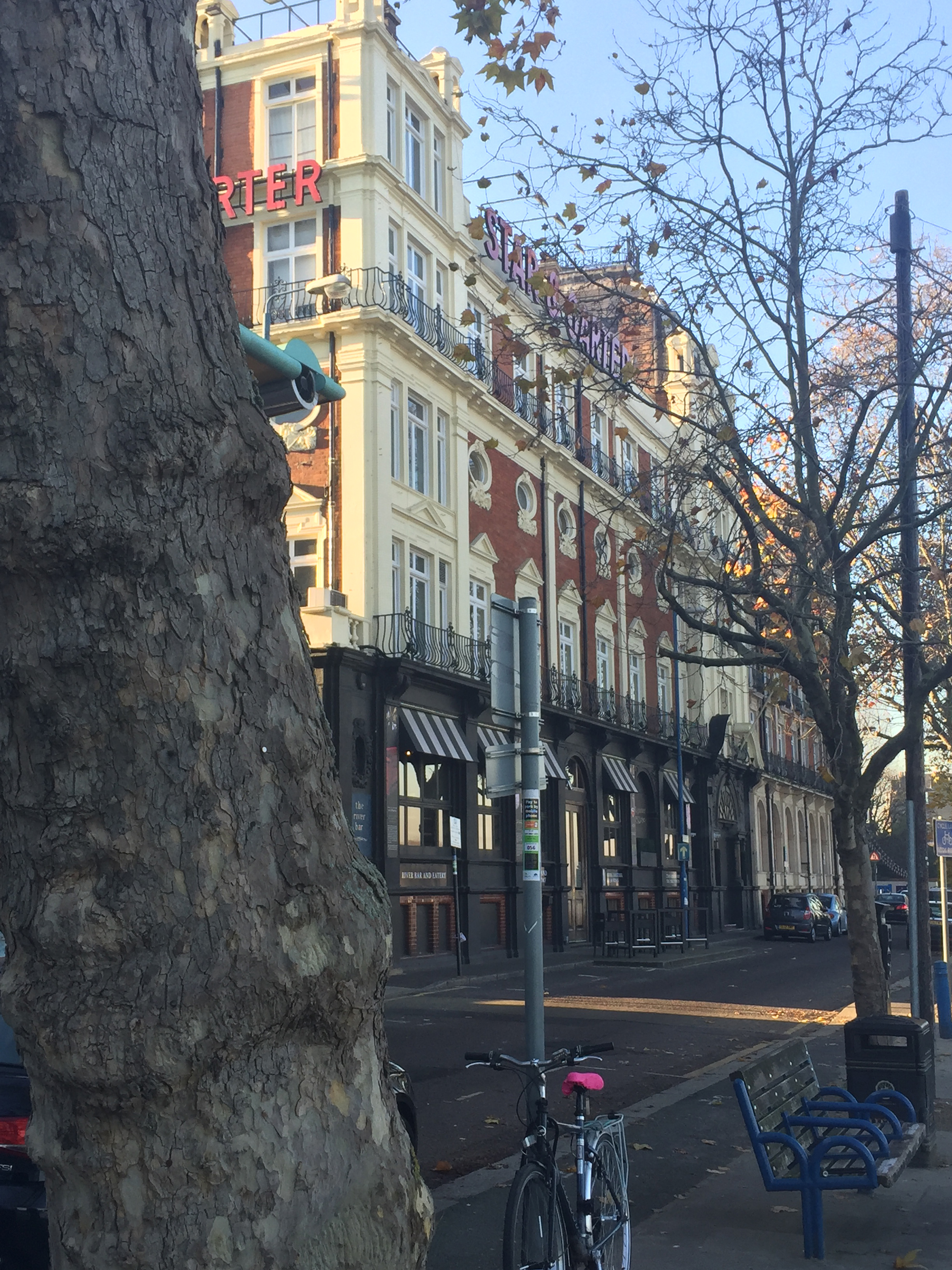
Back in Putney, another favourite was the Star & Garter . . .
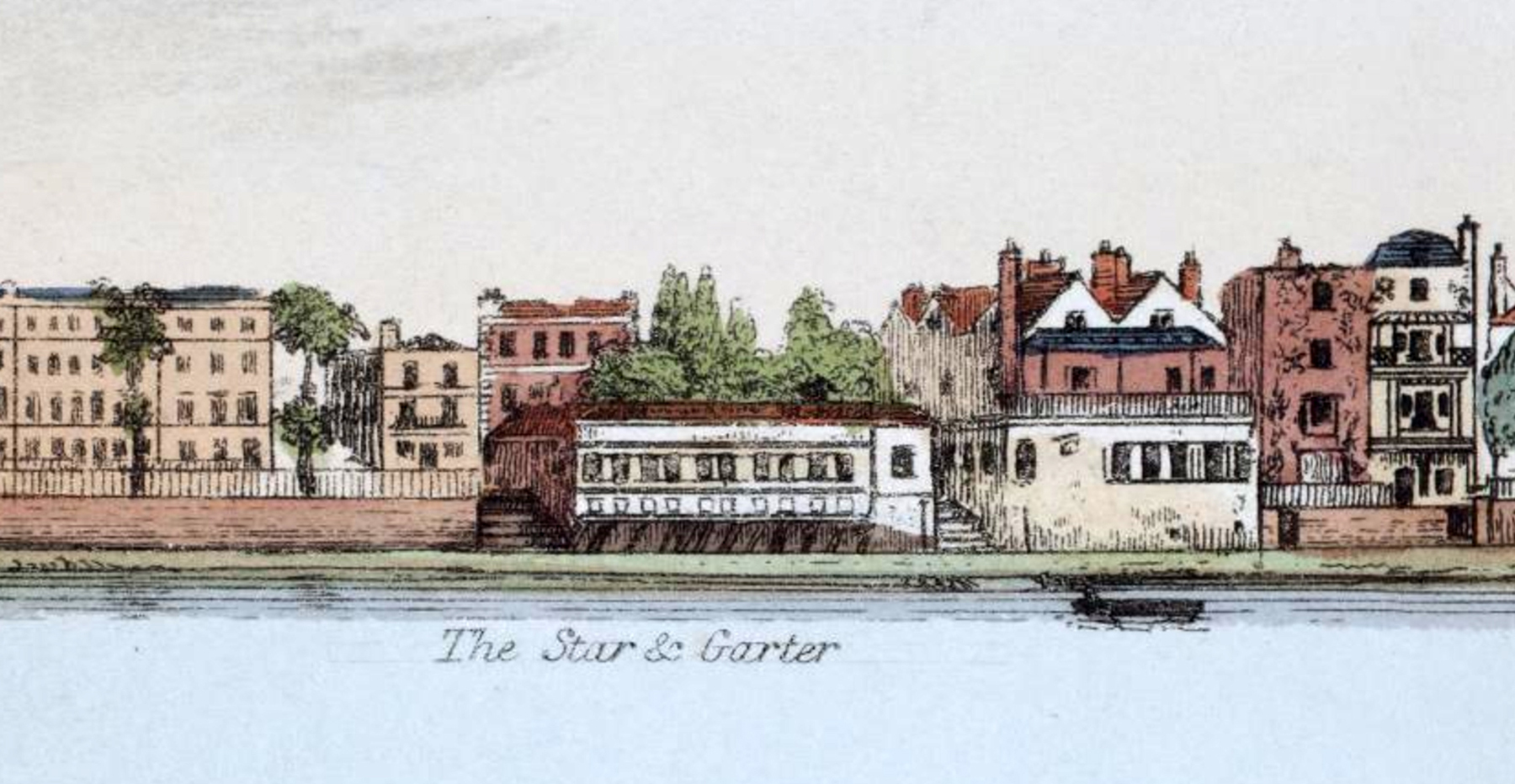
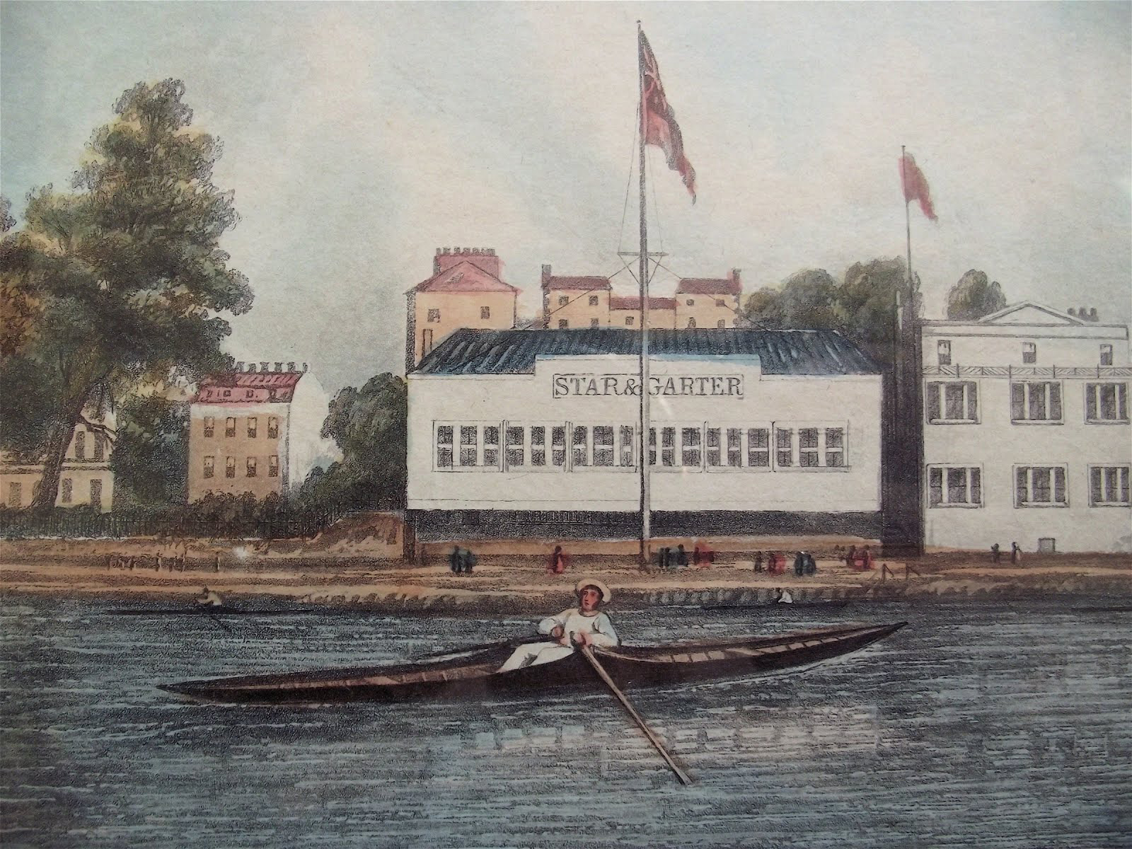
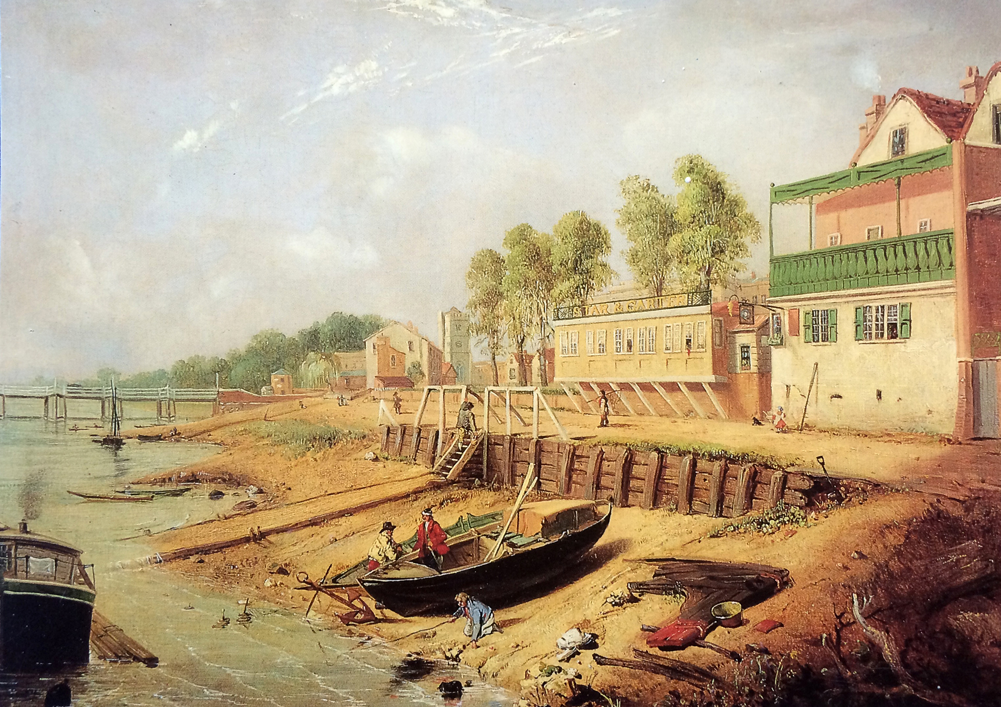
. . . which carries on today, sadly with any evidence of rowing removed.
There was also the Duke’s Head . . .
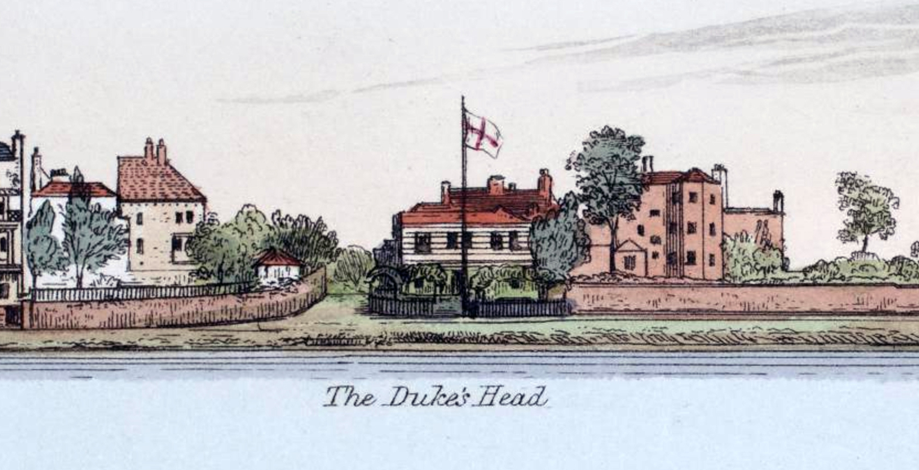
. . . once at the far upstream end of Putney with only open countryside beyond . . .
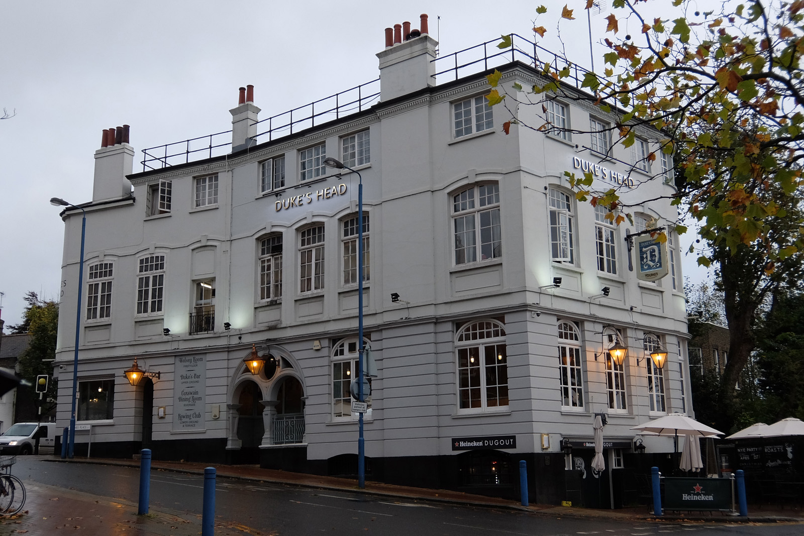
. . . while today you walk past a grander Duke’s Head . . .
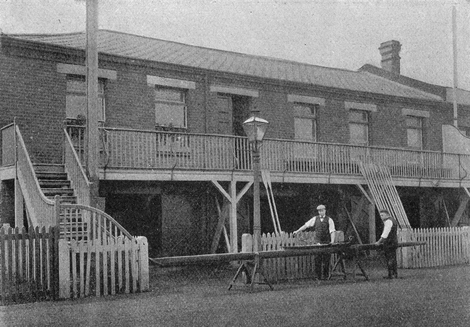
. . . to the row of boathouses that were added beginning in the middle of the 19th century.
In the years since 1829, Putney has become ever more important to rowers. As metropolitan London grew and grew, the urban Thames Tideway became increasingly less amenable to rowing, with increased pollution, large steam-powered boats further chopping up its waters and embankments hemming it in. As bridges proliferated, train tracks were laid and roads improved, Thames watermen lost their livelihoods, professional rowing competitions withered and died, and amateur rowing moved inexorably upstream to escape the degradation.
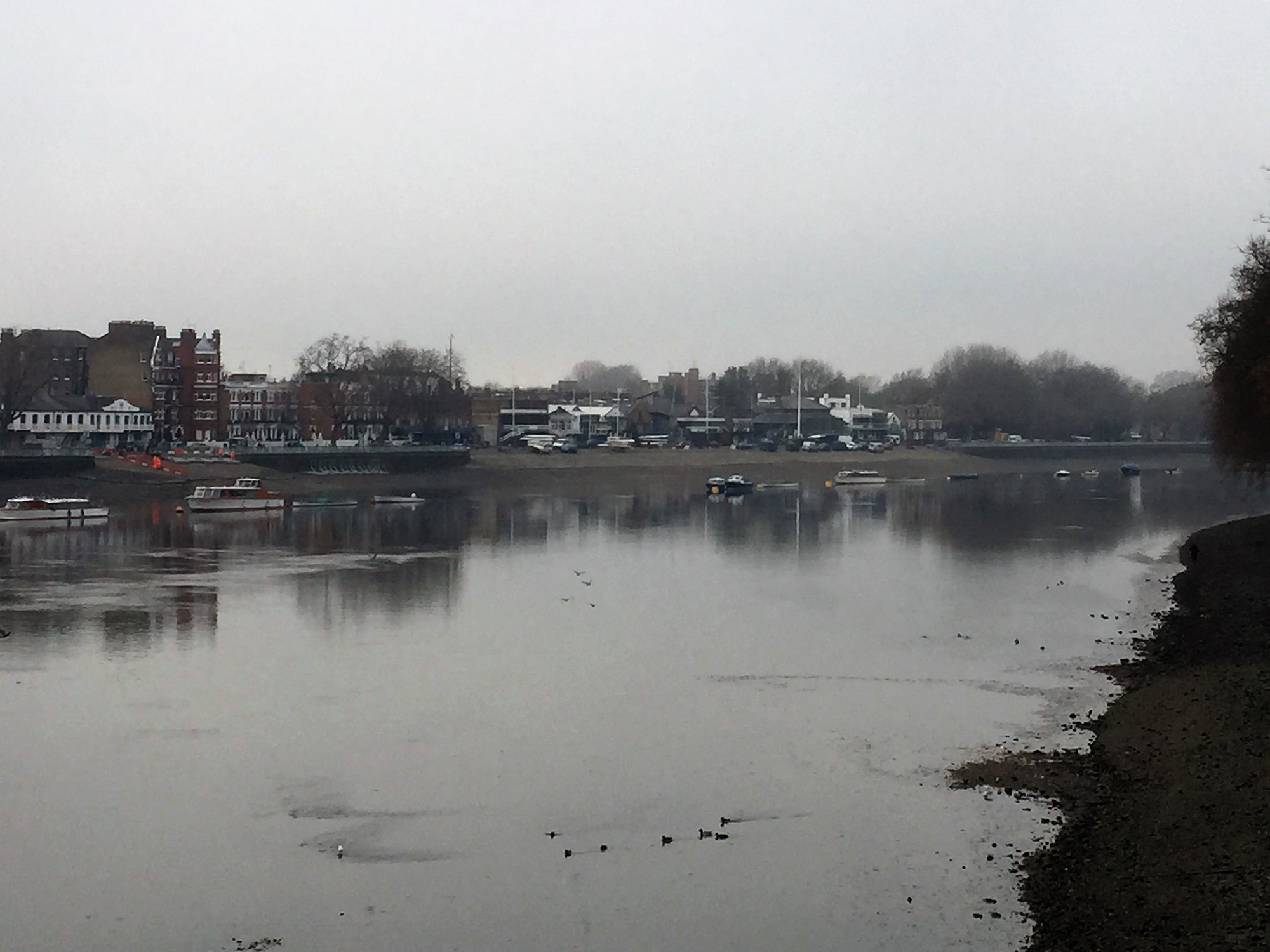
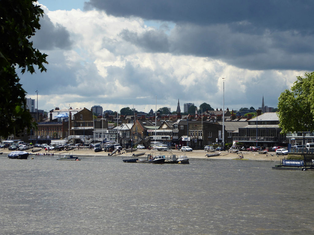
Today the Putney embankment is home to numerous boat clubs, and Putney Bridge serves as the start line of the annual Oxford-Cambridge Boat Race.

In the mid-19th century, the construction of the Albert Embankment forced even Leander Club to abandon its birthplace in Lambeth, and for several decades it resided in Putney . . .
. . . before migrating even further upstream to its current location in Henley, just a short walk from where we have gathered today.

This concludes our visual journey along the Thames Tideway of 1829, but I do hope that each of you is now motivated to take one of the regular ferries that travel the Thames between the Pool of London and Putney.
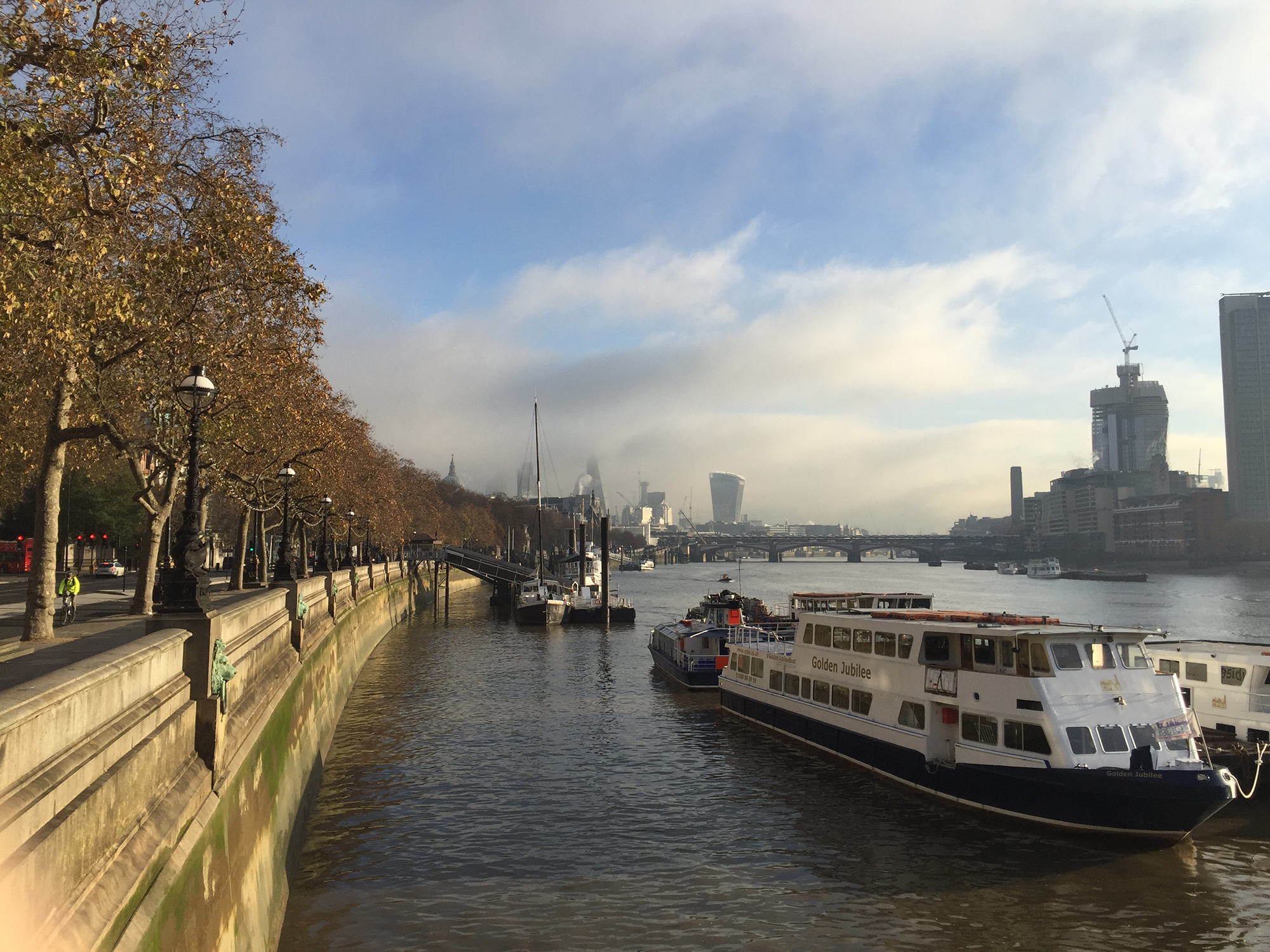
Those amongst you with the sharpest of eyes will spot the occasional set of stairs. Yes, some have survived.
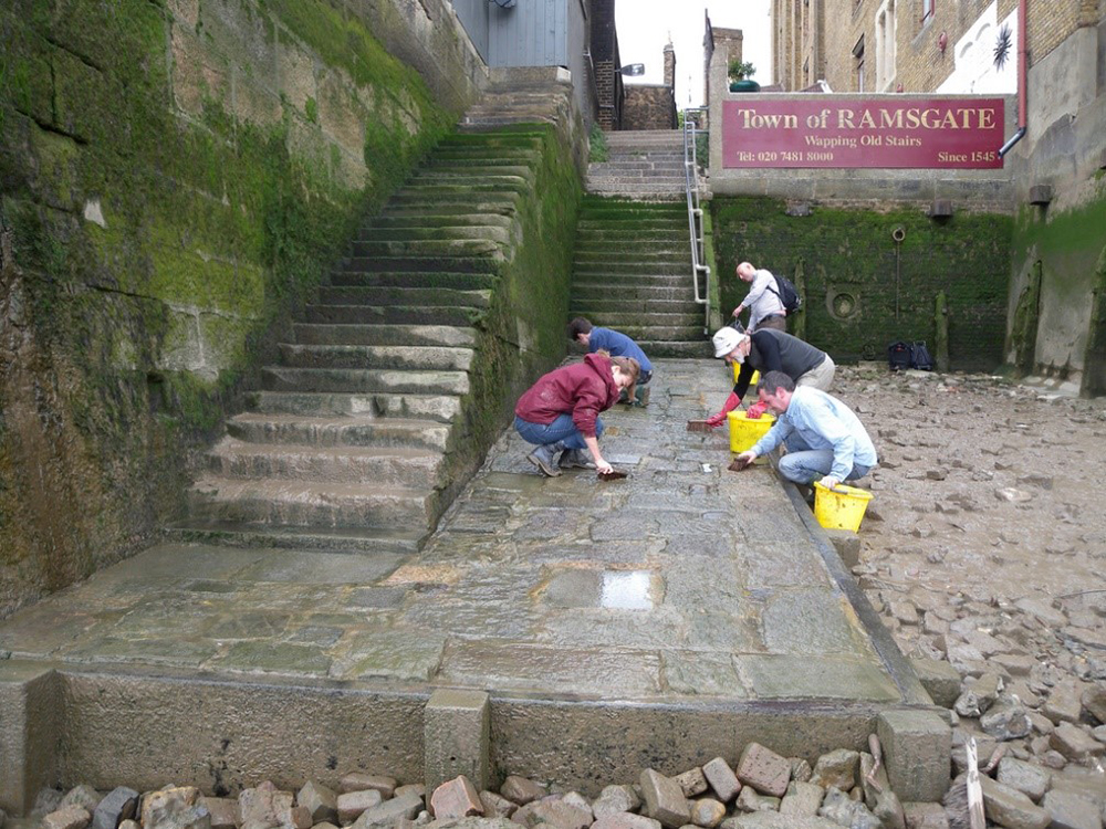
Here is Wapping Old Stairs – today a site for urban archeologists – but watch yourself! It has been a very long time since an apprentice waterman has kept these steps slime-free.
And hopefully, those amongst you with the sharpest of imaginations will squint your eyes and see again for yourselves the Thames Tideway as it looked in 1829.
Thank you for your attention.

Informative. Thanks, Peter. – Don Costello